
Файл:Western Han Mawangdui Silk Map.JPG
Исходный файл (3675 × 3549 пкс, размер файла: 3,07 МБ, MIME-тип: image/jpeg)
Описание
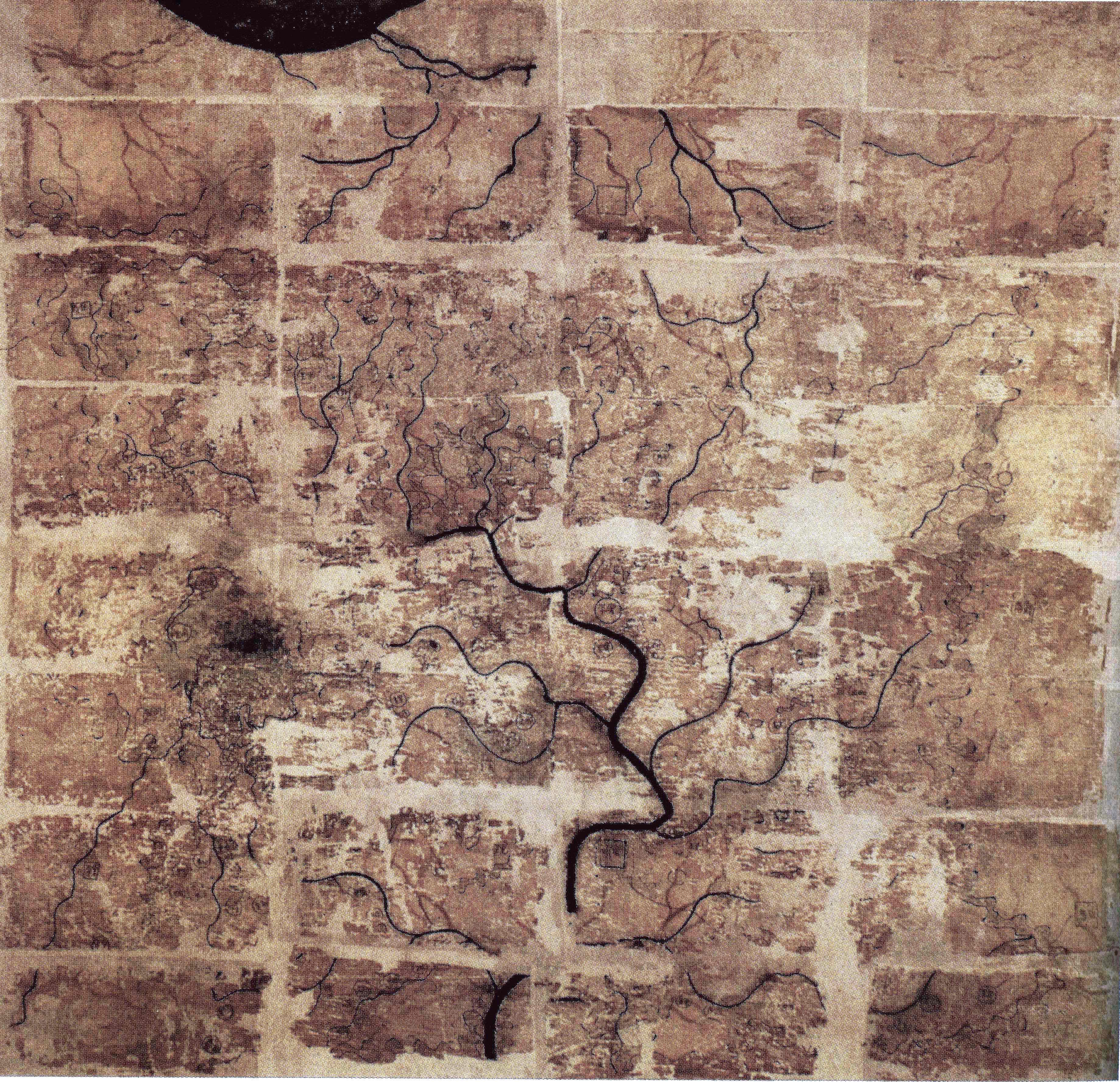
| Описание | A Chinese topographic map (with the south positioned at the top) from Mawangdui tomb 3; dated to the early Western Han period (183–168 BC); length is 96 cm; width is 96 cm; the map is made of ink on silk. It is now housed in the Hunan Provincial Museum, Changsha. The map depicts a large territory in southern China spanning from the imperial fiefdom of Changsha (a semi-autonomous kingdom within the Han Empire, now modern-day Hunan) to the independent and sometimes hostile Kingdom of Nanyue in what is now modern-day Guangdong and northern Vietnam. |
|---|---|
| Источник | Scanned from Barbieri-Low, Anthony J. (2007). Artisans in Early Imperial China. Seattle and London: University of Washington Press. ISBN 0295987138. Page 174. |
| Время создания | 2nd century BC (anywhere from 183 to 168 BC) |
| Автор или правообладатель | Anonymous ancient Chinese cartographer — Лицензия: Public domain (в общественном достоянии) |
| Другие версии файла | — |
Источник файла — сайт Wikimedia Commons, куда он был загружен под одной из свободных лицензий ( https://commons.wikimedia.org/wiki/File:Western_Han_Mawangdui_Silk_Map.JPG ). Авторов, работавших над этим файлом см. в истории файла: https://commons.wikimedia.org/w/index.php?title=File:Western_Han_Mawangdui_Silk_Map.JPG&action=history
В общем случае в статьях энциклопедии Руниверсалис файлы используются в соответствии со статьёй 1274 Гражданского кодекса Российской Федерации.
История файла
Нажмите на дату/время, чтобы увидеть версию файла от того времени.
| Дата/время | Миниатюра | Размеры | Участник | Примечание | |
|---|---|---|---|---|---|
| текущий | 13:24, 30 мая 2025 | | 3675 × 3549 (3,07 МБ) | SubBot (обсуждение | вклад) | == Описание == {{Изображение | описание = A Chinese topographic map (with the south positioned at the top) from Mawangdui tomb 3; dated to the early Western Han period (183–168 BC); length is 96 cm; width is 96 cm; the map is made of ink on silk. It is now housed in the Hunan Provincial Museum, Changsha. The map depicts a large territory in southern China spanning from the imperial fiefdom of Changsha (a semi-autonomous kingdom within the Han Empire, now modern-day Hunan) to the independent... |
Вы не можете перезаписать этот файл.
Использование файла
Следующий файл является дубликатом этого файла (подробности):
- Файл:Western Han Mawangdui Silk Map.JPG на общем хранилище
Следующая страница использует этот файл: