
Файл:Southern Madeira.jpg
Размер этого предпросмотра: 800 × 513 пкс. Другие разрешения: 2560 × 1643 пкс | 3411 × 2189 пкс.
Исходный файл (3411 × 2189 пкс, размер файла: 1,11 МБ, MIME-тип: image/jpeg)
Описание
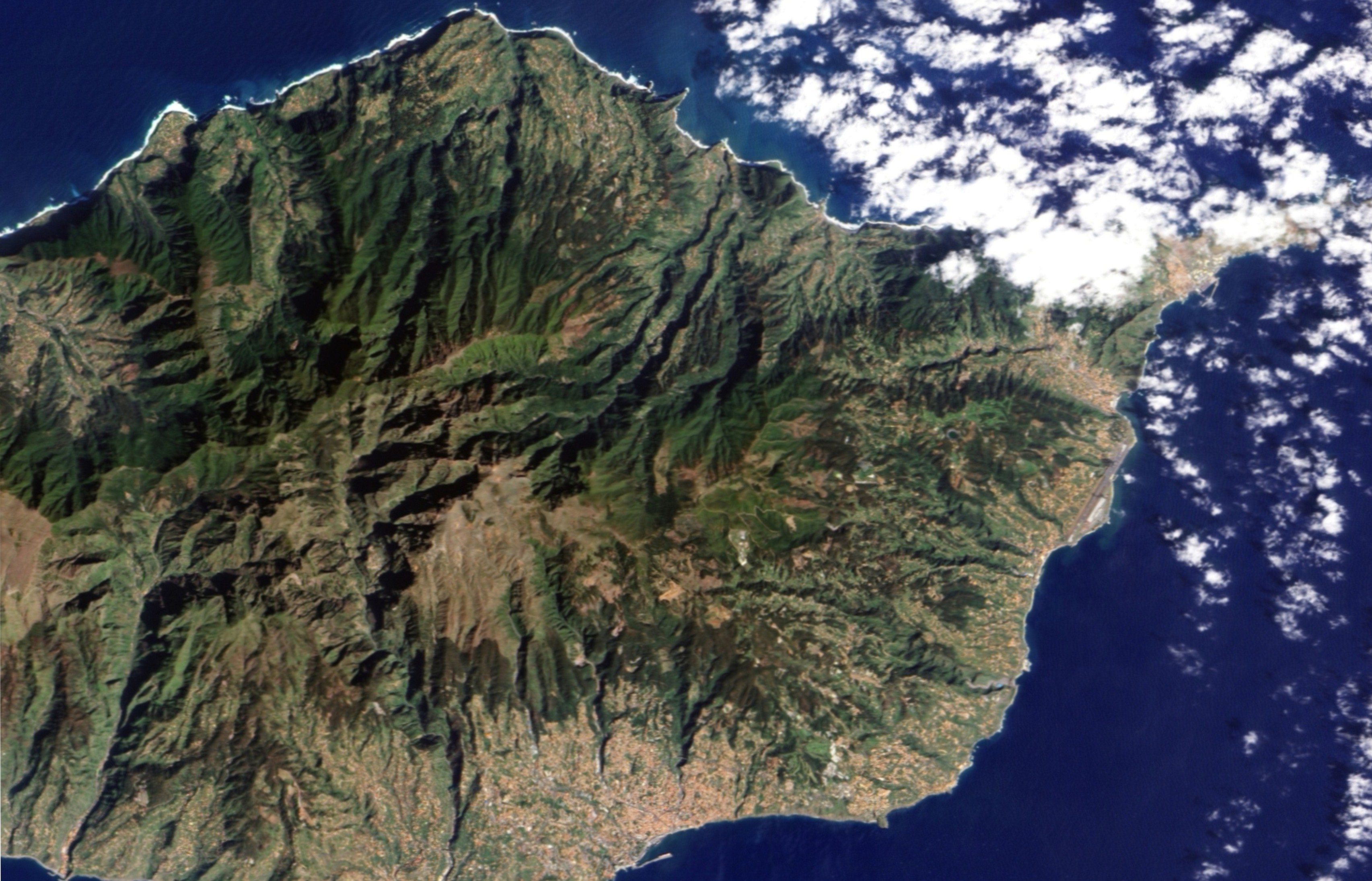
| Описание | Two topographic features characterize this part of the Madeiran landscape: steep mountains and deep ravines. Both landforms are evident in this image. Deep ravines define the path water routinely takes off the island. In shadow in the morning sunlight, the ravines are like dark wrinkles radiating from the centre of the island in this image. The cities, the colour of terracotta roof tiles, are built mostly around the ravines in this region with two notable exceptions. The small town of Ribeira Brava sits at the mouth of a large ravine that extends from the heart of the island. The second exception is Funchal, the island’s capital. Three rivers run from the mountains into the city. The deep ravines that bring two of the rivers into the city are evident in the image. The rivers are lined with some of the city’s primary roads, and they come together in a “v” near the harbour. |
|---|---|
| Источник | NASA Earth Observatory |
| Время создания | 2007-03-10 |
| Автор или правообладатель | Jesse Allen — Лицензия: Public domain (в общественном достоянии) |
| Другие версии файла | — |
Источник файла — сайт Wikimedia Commons, куда он был загружен под одной из свободных лицензий ( https://commons.wikimedia.org/wiki/File:Southern_Madeira.jpg ). Авторов, работавших над этим файлом см. в истории файла: https://commons.wikimedia.org/w/index.php?title=File:Southern_Madeira.jpg&action=history
В общем случае в статьях энциклопедии Руниверсалис файлы используются в соответствии со статьёй 1274 Гражданского кодекса Российской Федерации.
История файла
Нажмите на дату/время, чтобы увидеть версию файла от того времени.
| Дата/время | Миниатюра | Размеры | Участник | Примечание | |
|---|---|---|---|---|---|
| текущий | 14:50, 13 октября 2024 | | 3411 × 2189 (1,11 МБ) | SubBot (обсуждение | вклад) | == Описание == {{Изображение | описание = Two [https://commons.wikimedia.org/wiki/Category:Topography topographic] features characterize this part of the Madeiran landscape: steep [https://commons.wikimedia.org/wiki/Mountain mountains] and deep ravines. Both landforms are evident in this image. Deep ravines define the path [https://commons.wikimedia.org/wiki/Water water] routinely takes off the island. In [https://commons.wikimedia.org/wiki/Shadow shadow] in the [https://commons.wikimedia.or... |
Вы не можете перезаписать этот файл.
Использование файла
Следующий файл является дубликатом этого файла (подробности):
- Файл:Southern Madeira.jpg на общем хранилище
Следующая страница использует этот файл: