


Файл:PIA02820.jpg
Размер этого предпросмотра: 800 × 554 пкс. Другие разрешения: 2560 × 1772 пкс | 4000 × 2769 пкс.


Исходный файл (4000 × 2769 пкс, размер файла: 1,06 МБ, MIME-тип: image/jpeg)
Описание
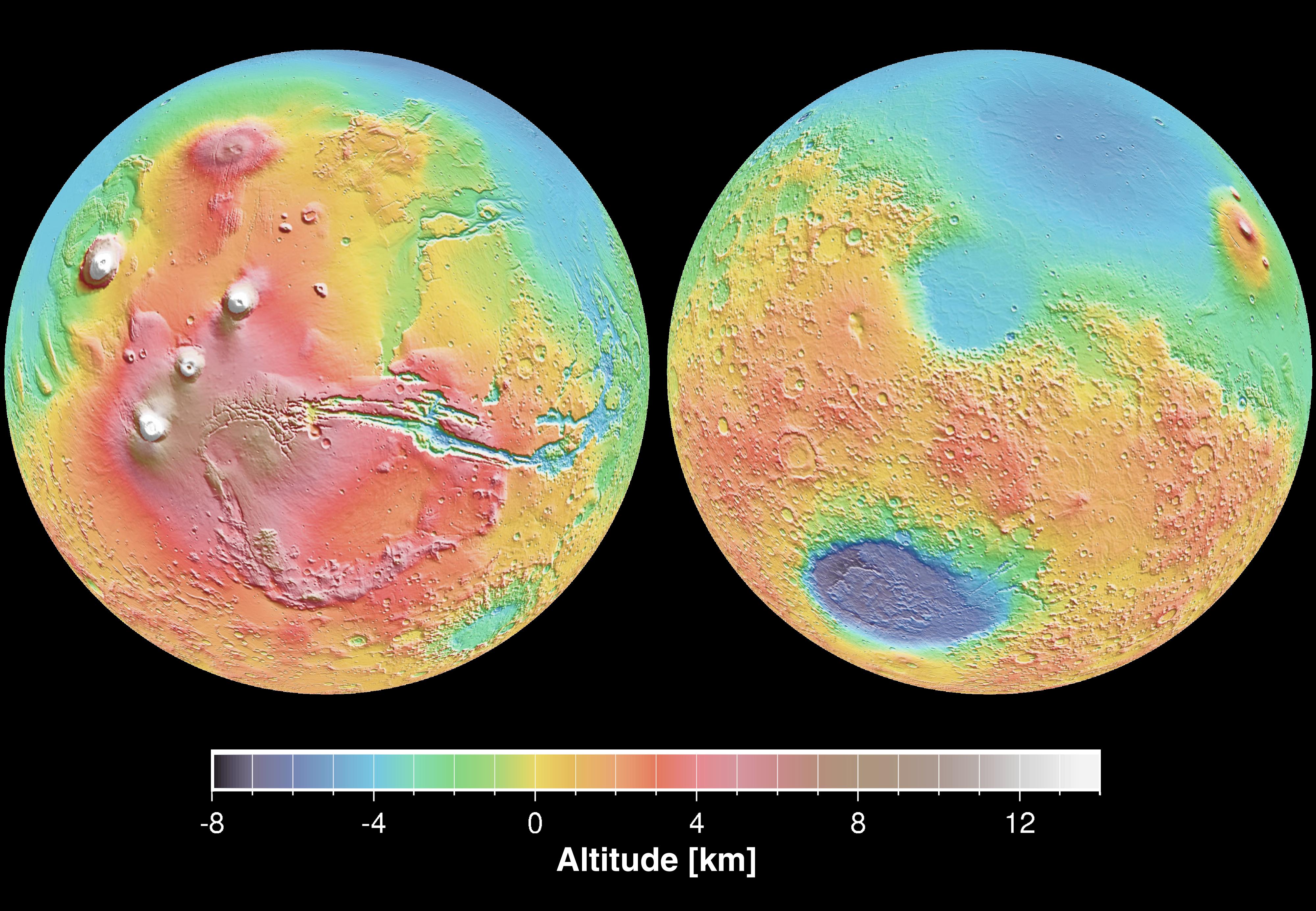
| Описание | These maps are global false-color topographic views of Mars at different orientations from the Mars Orbiter Laser Altimeter (MOLA). The maps are orthographic projections that contain over 200,000,000 points and about 5,000,000 altimetric crossovers. The spatial resolution is about 15 kilometers at the equator and less at higher latitudes. The vertical accuracy is less than 5 meters. The right hand image view features the Hellas impact basin (in purple, with red annulus of high standing material). The left hand features the Tharsis topographic rise (in red and white). Note also the subtle textures associated with resurfacing of the northern hemisphere lowlands in the vicinity of the Utopia impact basin. This data was compiled by the Mars Orbiter Laser Altimeter (MOLA) Team, led by David Smith at the Goddard Space Flight Center in Greenbelt, MD. |
|---|---|
| Источник | http://photojournal.jpl.nasa.gov/catalog/PIA02820 |
| Время создания | 2001-01-17 |
| Автор или правообладатель | NASA/JPL — Лицензия: Public domain (в общественном достоянии) |
| Другие версии файла | — |
Источник файла — сайт Wikimedia Commons, куда он был загружен под одной из свободных лицензий ( https://commons.wikimedia.org/wiki/File:PIA02820.jpg ). Авторов, работавших над этим файлом см. в истории файла: https://commons.wikimedia.org/w/index.php?title=File:PIA02820.jpg&action=history


В общем случае в статьях энциклопедии Руниверсалис файлы используются в соответствии со статьёй 1274 Гражданского кодекса Российской Федерации.
История файла
Нажмите на дату/время, чтобы увидеть версию файла от того времени.
| Дата/время | Миниатюра | Размеры | Участник | Примечание | |
|---|---|---|---|---|---|
| текущий | 20:07, 15 декабря 2023 | | 4000 × 2769 (1,06 МБ) | I, Robot (обсуждение | вклад) | == Описание == {{Изображение | описание = These maps are global false-color topographic views of Mars at different orientations from the Mars Orbiter Laser Altimeter (MOLA). The maps are orthographic projections that contain over 200,000,000 points and about 5,000,000 altimetric crossovers. The spatial resolution is about 15 kilometers at the equator and less at higher latitudes. The vertical accuracy is less than 5 meters. The right hand image view features the Hellas impact basin (in purpl... |
Вы не можете перезаписать этот файл.
Использование файла
Следующий файл является дубликатом этого файла (подробности):

- Файл:PIA02820.jpg на общем хранилище
Следующая страница использует этот файл:
