
Файл:Borneo fires October 2006.jpg
Исходный файл (3200 × 2400 пкс, размер файла: 763 КБ, MIME-тип: image/jpeg)
Описание
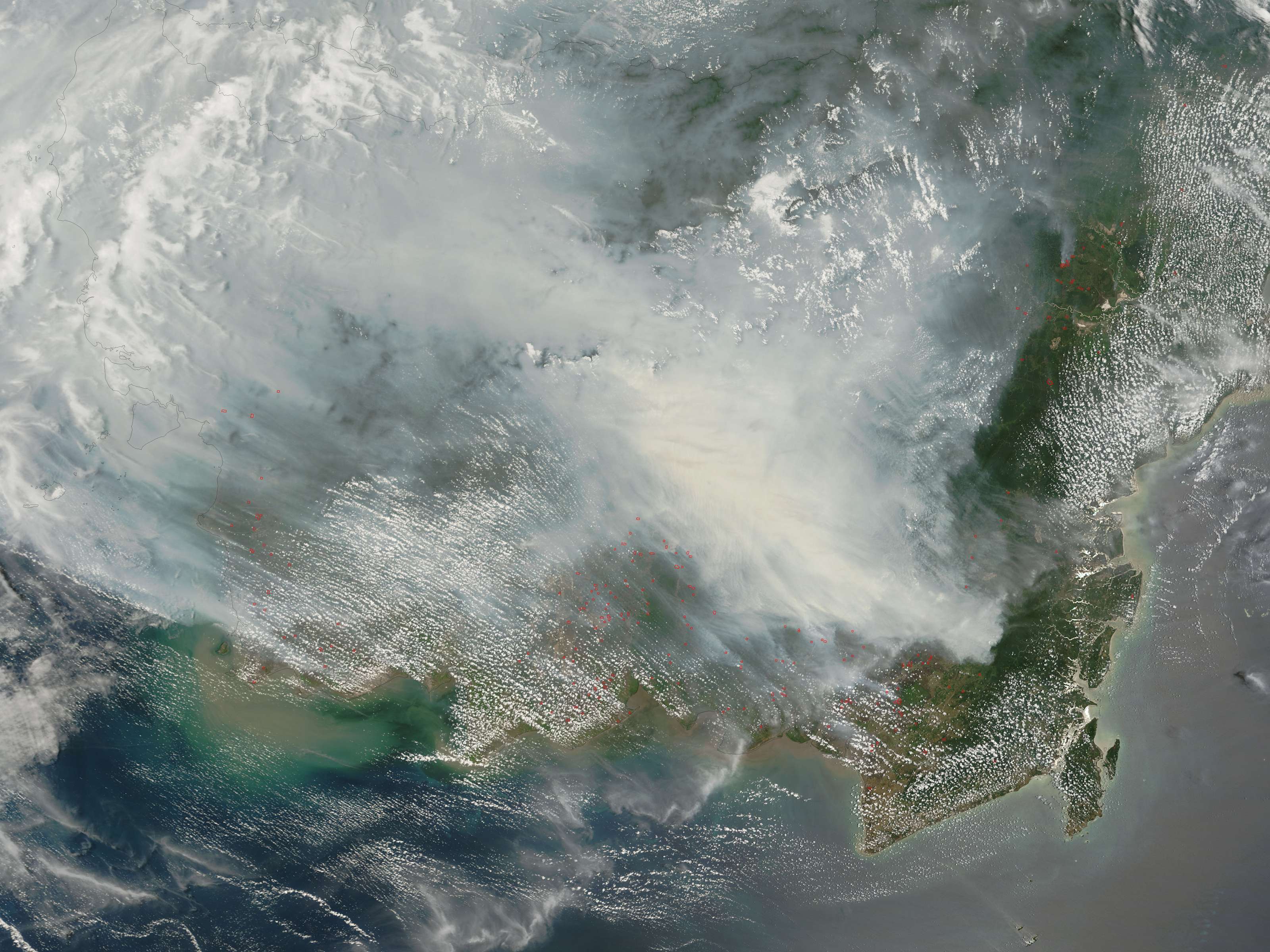
| Описание | Fires on Borneo Thick smoke hung over the island of Borneo when the Moderate Resolution Imaging Spectroradiometer (MODIS) on NASA’s Terra satellite passed overhead on October 5, 2006. The sensor detected scores of fires (locations marked in red) in the Kalimantan province of Indonesia, and smoke billowed northward over the Malaysian part of the island, as well. The fires occur annually in the dry season (August-October), caused mainly by land-clearing and other agricultural fires. Fires escape control and burn into forests and peat-swamp areas. Fires in peat—thick layers of dead, but un-decayed vegetation—are extremely smoky and difficult to put out. Some of the blazes will only be extinguished when the monsoon rains start in upcoming weeks. |
|---|---|
| Источник | http://earthobservatory.nasa.gov/NaturalHazards/natural_hazards_v2.php3?img_id=13916 |
| Время создания | 2006-10-05 |
| Автор или правообладатель | NASA image by Jeff Schmaltz, MODIS Rapid Response Team. — Лицензия: Public domain (в общественном достоянии) |
| Другие версии файла | — |
Источник файла — сайт Wikimedia Commons, куда он был загружен под одной из свободных лицензий ( https://commons.wikimedia.org/wiki/File:Borneo_fires_October_2006.jpg ). Авторов, работавших над этим файлом см. в истории файла: https://commons.wikimedia.org/w/index.php?title=File:Borneo_fires_October_2006.jpg&action=history
В общем случае в статьях энциклопедии Руниверсалис файлы используются в соответствии со статьёй 1274 Гражданского кодекса Российской Федерации.
История файла
Нажмите на дату/время, чтобы увидеть версию файла от того времени.
| Дата/время | Миниатюра | Размеры | Участник | Примечание | |
|---|---|---|---|---|---|
| текущий | 09:52, 4 октября 2023 | | 3200 × 2400 (763 КБ) | I, Robot (обсуждение | вклад) | == Описание == {{Изображение | описание = <p>Fires on Borneo </p> Thick smoke hung over the island of Borneo when the Moderate Resolution Imaging Spectroradiometer (MODIS) on NASA’s Terra satellite passed overhead on October 5, 2006. The sensor detected scores of fires (locations marked in red) in the Kalimantan province of Indonesia, and smoke billowed northward over the Malaysian part of the island, as well. The fires occur annually in the dry season (August-October), caused mainly by land... |
Вы не можете перезаписать этот файл.
Использование файла
Следующая страница использует этот файл: