
Файл:Manilajf9619 37.JPG
Размер этого предпросмотра: 449 × 599 пкс. Другие разрешения: 1536 × 2048 пкс | 2764 × 3686 пкс.
Исходный файл (2764 × 3686 пкс, размер файла: 385 КБ, MIME-тип: image/jpeg)
Описание
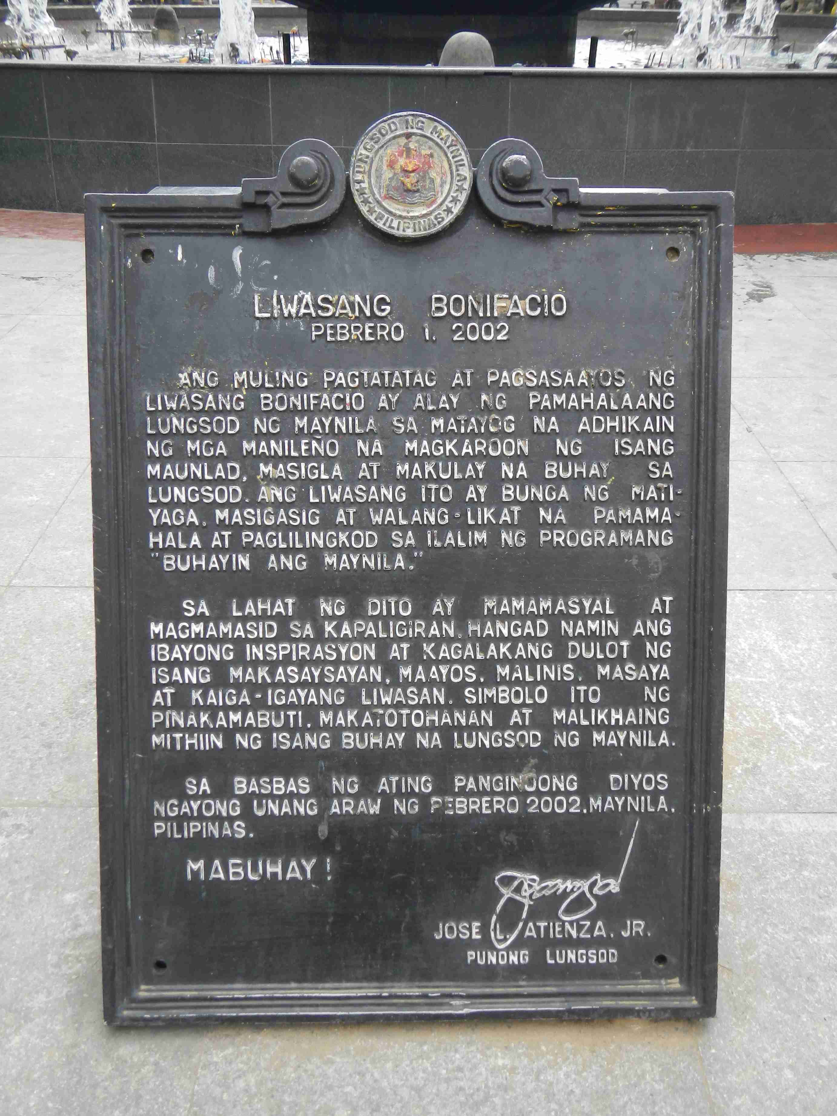
| Описание | Upload Wizard photos (general description of the landmarkds, angle by angle photography of the city, town, rivers, bridges and interesting points) - Escolta Street[1] beside the a) Santa Cruz Bridge [2] connecting the district of Santa Cruz from Plaza Goiti to Arroceros Street in the old city center of Manila renamed as MacArthur Bridge after General Douglas MacArthur a simpler reinforced concrete beam bridge; the FEATI University, Barangay 303 Zone29 Hall [3] b) General Douglas McArthur Monument, Statues, Battle of Leyte [4] Palo[5] Beach, Leyte, 20 October 1944 20 October – 31 December 1944 "The Landing in Leyte" Memorial (Gen. Douglas MacArthur Monument) (Manila) [6] Coordinates: 14°35'44"N 120°58'49"E Battle of Leyte Gulf [7] 23–26 October 1944 [8] c) Manila Central Post Office [9] and d) Liwasang Bonifacio; Post Office building was named "Plaza Lawton" before it was renamed in 1963 as Liwasang Bonifacio Henry Ware Lawton [10] List of parks in Manila[11] The original location is now called Liwasang Bonifacio (Plaza Lawton) Parián[12] The Parian / Pantin, historic name Parian de Arroceros (Arroceros : cultivators of rice, Spanish) was an area adjacent to Intramuros built to house Chinese merchants in Manila in the 16th and 17th centuries during the Spanish occupation of The Philippines.[1] The gate connecting it and Intramuros (where most of the Spanish colonial and administrative government was located) was called Puerta del Parian; today, this space is occupied by the Metropolitan Theater; The current day areas of Lawton and Arroceros Forest park [13] occupy the area previously known as Parian. |
|---|---|
| Источник | Own work |
| Время создания | 2014-01-24 11:22:20 |
| Автор или правообладатель | Ramon FVelasquez — Лицензия: CC BY-SA 3.0 (Creative Commons Attribution-Share Alike 3.0) https://creativecommons.org/licenses/by-sa/3.0 |
| Другие версии файла | — |
Источник файла — сайт Wikimedia Commons, куда он был загружен под одной из свободных лицензий ( https://commons.wikimedia.org/wiki/File:Manilajf9619_37.JPG ). Авторов, работавших над этим файлом см. в истории файла: https://commons.wikimedia.org/w/index.php?title=File:Manilajf9619_37.JPG&action=history
В общем случае в статьях энциклопедии Руниверсалис файлы используются в соответствии со статьёй 1274 Гражданского кодекса Российской Федерации.
История файла
Нажмите на дату/время, чтобы увидеть версию файла от того времени.
| Дата/время | Миниатюра | Размеры | Участник | Примечание | |
|---|---|---|---|---|---|
| текущий | 18:10, 20 ноября 2023 | | 2764 × 3686 (385 КБ) | Я, робот (обсуждение | вклад) | == Описание == {{Изображение | описание = Upload Wizard photos (general description of the landmarkds, angle by angle photography of the city, town, rivers, bridges and interesting points) - Escolta Street[https://en.wikipedia.org/wiki/Escolta_Street [1]] beside the a) Santa Cruz Bridge [https://en.wikipedia.org/wiki/Santa_Cruz_Bridge [2]] connecting the district of Santa Cruz from Plaza Goiti to Arroceros Street in the old city center of Manila renamed as MacArthur Bridge after General Doug... |
Вы не можете перезаписать этот файл.
Использование файла
Следующая страница использует этот файл: